




- Calibsun | Expertise
On-Site Solar Data: The primary source of truth for accurate power forecasting
Introduction

On-site solar data refers to all ground-based measurements collected directly at a photovoltaic power plant (irradiance, power output, temperature, wind) to monitor real weather conditions in real time. For solar power forecasting, these in situ measurements are not a secondary input: they are the primary source of truth that satellite imagery and numerical weather prediction (NWP) models cannot replace at short forecast horizons. For IPPs, aggregators, and grid operators managing imbalance exposure and DSM penalties, the quality of onsite measurements directly conditions forecast accuracy, curtailment detection, and intraday power forecast reliability. On-site solar data enables model recalibration against actual plant behavior, spatial irradiance mapping across large utility-scale sites, and real-time state estimation: three capabilities that satellite-derived irradiance products and NWP alone cannot deliver.
Key facts
- On-site solar data refers to all ground-based measurements collected directly at a photovoltaic power plant (irradiance, power output, temperature, wind speed…) to monitor local weather conditions in real time.
- Satellite (3–10 km2 refreshed every 15 minutes + lag) and NWP (20 km2, refreshed every 6 h) lack the spatial and temporal resolution required for intrahour forecasting on utility-scale PV plants.
- Quality check and historical data are essential: filtering outliers, detecting sensor drift, and leveraging multi-year time series enable robust model calibration and real-time recalibration, reducing intraday nRMSE.
- CalibSun combines existing on-site data or added sky-imagers, satellite imagery, and NWP.
The main sensors deployed at a solar power plant
Photovoltaic power plant equipped for power production forecasting typically integrate several categories of sensors, each measuring a different physical quantity.
A photovoltaic solar power plant typically integrates several sensor categories, used by Calibsun for power production forecasting. Each sensor is measuring distinct physical quantities for solar energy management.
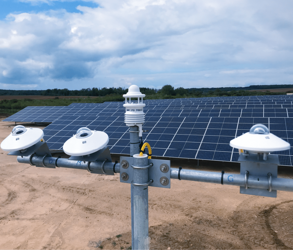
GHI & Weather data
Ground data delivers two capabilities that remote sensing structurally cannot. The first is real-time GHI measurement: a pyranometer provides the exact local irradiance, and SCADA tells the model exactly how much electricity the plant is injecting into the grid. This current-state information is essential for short term forecasting.
Plant-specific model calibration is the second capability. Every photovoltaic power plant has a unique relationship between incident irradiance and power output. Only historical on-site time series (GHI and production measured over a sufficient period) allow CalibSun’s algorithm to learn this signature.
- Product page
How CalibSun Integrates On-Site data ?

Data quality control and historical calibration
Before any on-site data enters the forecasting algorithm, it passes through a systematic quality control process. CalibSun flags and removes data that are physically inconsistent: values exceeding the theoretical clear-sky envelope, production readings inconsistent with concurrent solar data and temperature, or sensor readings exhibiting step changes characteristic of hardware failure.
The cleaned historical dataset, ideally covering at least one year of continuous operation, then serves as the training base for the forecasting model, encoding the plant’s energy production behavior across the full range of seasonal and weather conditions.

An analog ensemble algorithm
CalibSun’s forecasting approach is built on an analog ensemble algorithm: a machine learning technique that identifies, in the historical archive of on-site measurements, the past situations most similar to current weather conditions. The energy production outcomes observed during those analogs construct the forecast distribution, both the deterministic central estimate and the full probabilistic envelope from P10 to P90. While deep learning approaches are increasingly used in solar forecasting, the analog ensemble method offers superior interpretability and robustness on the limited historical datasets typical of operational PV sites. A minimum of one year of historical data is recommended at onboarding to ensure the analog pool covers the full range of seasonal conditions.

The real-time data workflow: frequency, latency, and seamless integration
CalibSun’s NEXT algorithm ingests on-site measurements continuously via API integration. The optimal temporal resolution is 1 minute. In practice, many clients transmit at 5-minute resolution, which is operationally sufficient for most solar forecasting applications. NEXT adapts automatically to the shortest temporal resolution available in the incoming data stream.
The algorithm operates seamlessly across data availability states. When onsite measurements are temporarily unavailable, the forecasting system continues to operate using satellite and NWP inputs alone. Short-term accuracy is reduced during these gaps, but the service does not interrupt. As measurements resume, the model recalibrates automatically and forecast accuracy is increased.
A minimum of one year of historical on-site data is strongly recommended at onboarding to ensure the analog pool covers the full range of seasonal conditions. Without this baseline, forecast quality improves progressively as on-site measurements accumulate.

Sky imagers: extending local observability below 30 minutes
For very short forecast horizons, below 60 minutes, and especially below 30 minutes, a different question becomes critical: what cloud structures are approaching the plant, and when will they reach it?
CalibSun deploys networks of sky cameras in a stereoscopic configuration: multiple cameras positioned around the plant capture simultaneous images of the sun and sky dome from different angles, enabling three-dimensional reconstruction of cloud positions, geometries, and trajectories. This is the only method capable of anticipating irradiance ramps at sub-30 minutes.
Why Satellite and NWP Data alone lack accuracy
Satellite-based solar irradiance data and numerical weather prediction models are essential tools in solar resource assessment and day-ahead weather forecasting. But they carry structural limitations that become critical at short forecast horizons, limitations that only on-site data can address.
The spatial resolution problem: what satellites and NWP cannot see
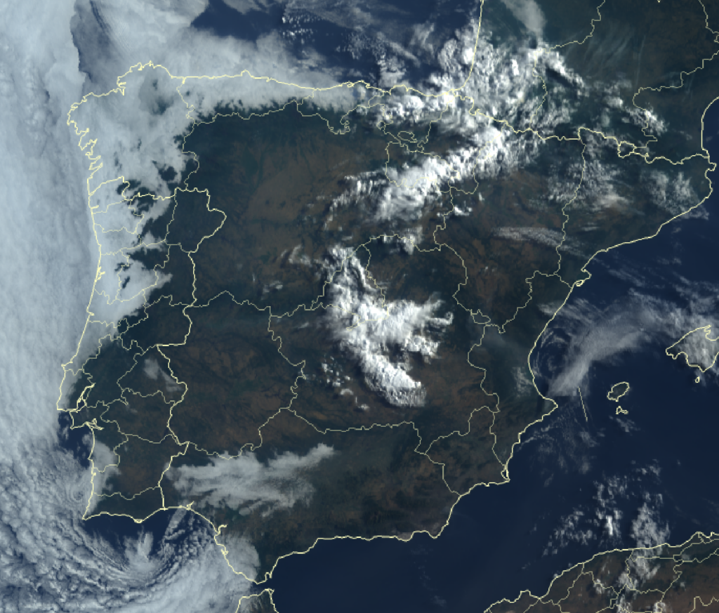
Satellite: 15 minutes + data retrieval and treatment lag at 2km2 resolution
Satellite irradiance products typically operate at spatial resolutions of several kilometers per pixel. For a utility-scale solar power plant, this means that the irradiance driving solar energy production is represented by a spatially smoothed estimate that cannot capture sub-kilometer output variability.
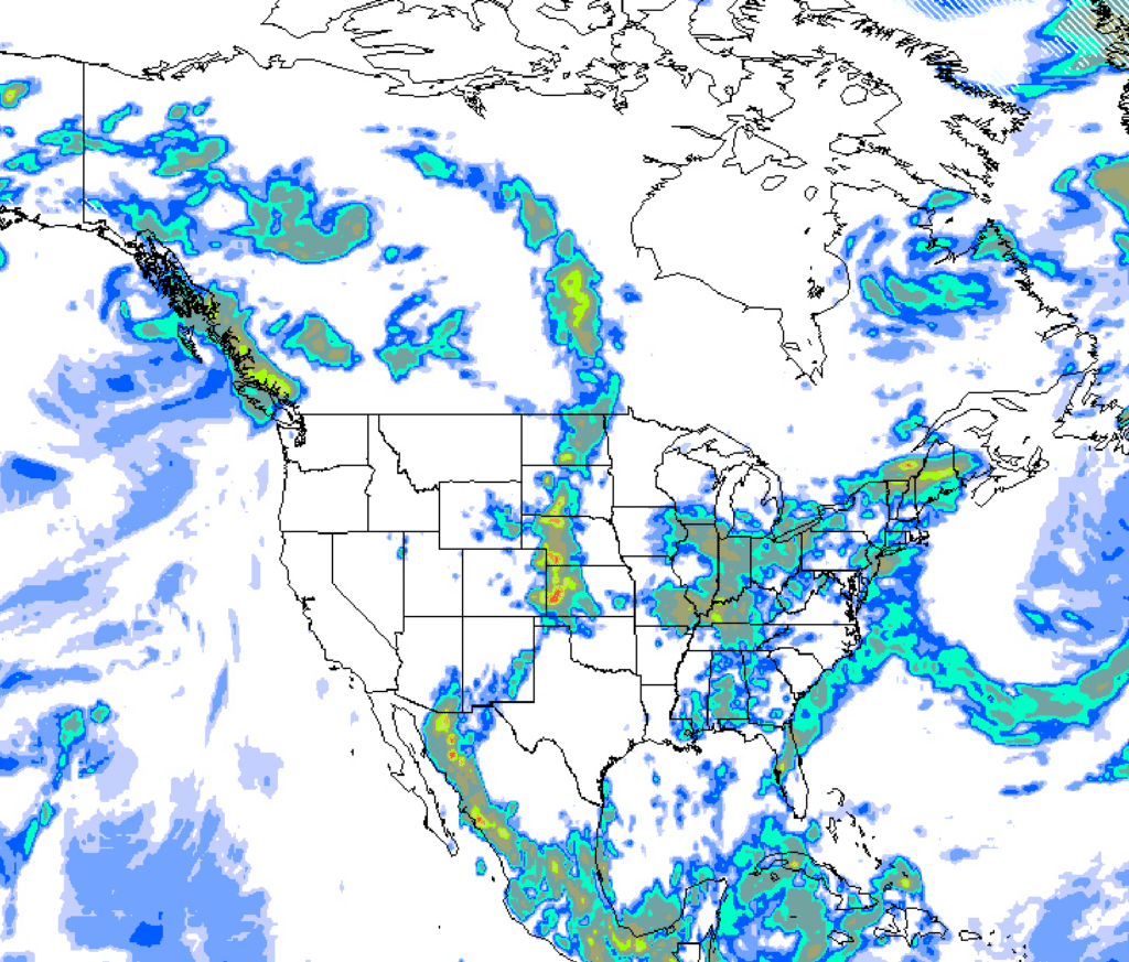
Meteorological model : 6h + data retrieval and treatment lag at 10km2 resolution
Numerical weather prediction models face a similar constraint, operating at spatial resolutions ranging from a few kilometers to tens of kilometers. At these scales, local weather conditions are either smoothed out or represented with significant temporal lag. At intraday horizons, satellite and NWP inputs alone produce power forecasts that miss the rapid irradiance ramps caused by passing cloud cover, precisely the events that drive imbalance exposure and DSM penalties.

- Questions
Frequently asked questions about on-site solar data
What is on-site solar data and why does it matter for solar power forecasting?
On-site solar data encompasses all ground measurements collected directly at photovoltaic installations: solar irradiance from pyranometers, electrical power output from SCADA systems, and meteorological variables. These in situ measurements provide real-time plant state and enable plant-specific model calibration — a core capability that satellite data and NWP cannot deliver. For the renewable energy industry, this insight drives reliable electricity generation and supports corporate sustainability goals and carbon reduction.
What is the difference between GHI and GTI in solar forecasting?
GHI (Global Horizontal Irradiance) measures total solar radiation on horizontal surfaces, while GTI (Global Tilted Irradiance) measures radiation on panel-tilted surfaces – the more relevant measurement for solar energy systems modeling. GTI derivation from GHI using transposition models enhances energy efficiency and design optimization for solar installations.
Can accurate solar forecasting be achieved without on-site measurements?
Satellite and NWP models enable day-ahead forecasting, but at intraday horizons, absence of on-site data significantly limits accuracy: satellites cannot capture sub-kilometer variability or plant-specific energy production behavior – critical for grid reliability and cost control in growing electricity consumption segments.
What happens to forecast quality when on-site data is temporarily unavailable?
CalibSun’s NEXT algorithm operates seamlessly across data states. When measurements are interrupted, satellite and NWP inputs sustain forecast continuity without manual intervention, reducing short-term accuracy during gaps but recovering automatically – ensuring reliable service and growing confidence in renewable energy deployment.